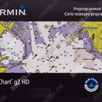
BLUECHART G3 HD – HXAF002R SOUTH AFRICA

R3,795
BlueChart g3 HD marine maps feature crisp labeling and an exceptionally smooth presentation on your chartplotter display. BlueChart g3 HD also offers smooth transitioning between zoom levels and seamless continuity across chart boundaries. *D*
- Description
- in the box
Description
Features:
– Derived from official charts and private sources to provide navigational aids, spot soundings, depth contours, tides and currents, and detailed harbours and marinas
– Depth Range Shading for up to 10 depth ranges enables you to view your target depth at a glance
– Up to 1-foot contours provide a more accurate depiction of the bottom structure for improved fishing charts and navigation in swamps, canals and marinas
– Shallow Water Shading feature allows for depth shading at a user-defined level to aid in navigation
– Worldwide coverage is available
– Keep your charts up to date with our industry-leading New Chart Guarantee and discount card update program
Advanced Chart Detail
Detailed charts help the mariner guide their boat in and out of port with confidence.
Depth Range Shading
Displays high-resolution Depth Range Shading for up to 10 depth ranges so you can view your designated target depth.
Detailed Contours
BlueChart g3 HD features 1-foot contours that provide a more accurate depiction of bottom structure for improved fishing charts and enhanced detail in swamps, canals and port plans.
Coverage
Detailed coverage of the coast of southern Africa from Namibe, Ang. to Angoche, Moz., including the South African cities of Cape Town and Port Elizabeth. Includes detailed coverage of Durban S. Af. and Maputo, Moz. Also includes detailed coverage of the Tristan da Cunha Group, the island of St. Helena, and the Prince Edward Islands.
Bluechart G3 HD – HXAF002R South Africa x 1